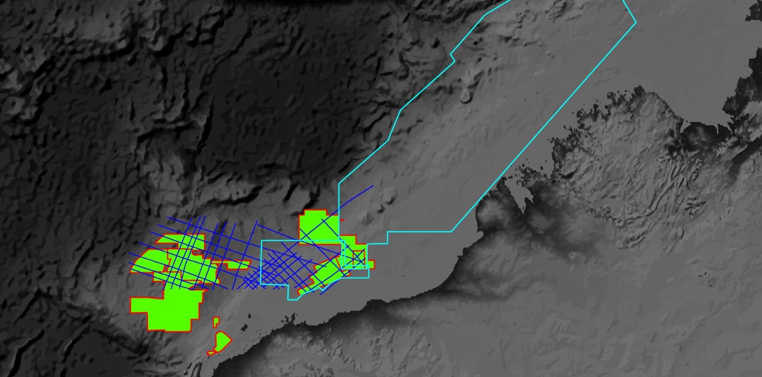

AUSTRALIAN ACREAGE 2019
This year's Offshore Petroleum Acreage details are announced by the Australian Government
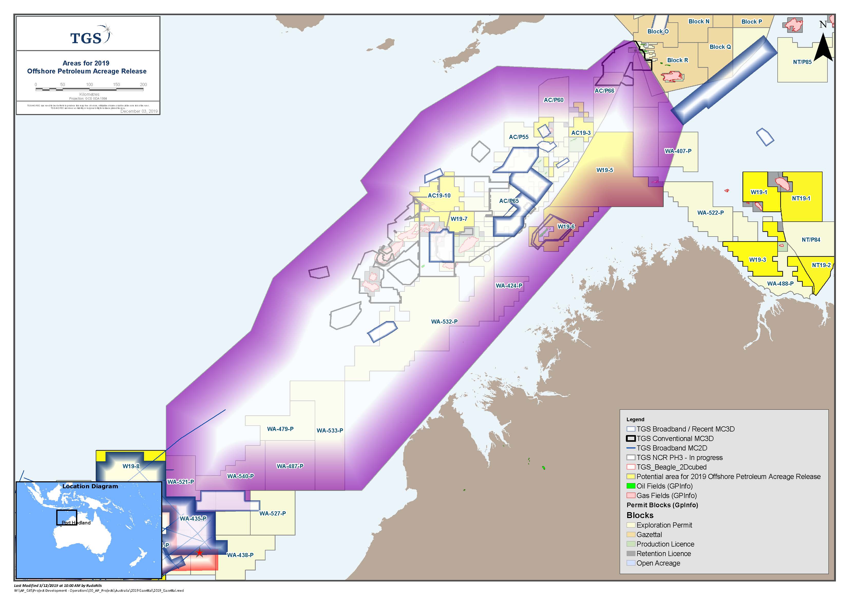
The Australian Government's dept. of Industry, Innovation and Science has released details of the 2019 areas in Australian waters for oil and gas exploration. There are over 45 blocks covered by TGS data that are available for bidding, with a closing date for submission of bids being March 2020.
Successful bidders will be offered an offshore petroleum exploration permit. This six-year title can be renewed for a further two periods of five years.
See the full Australian Government press release here:
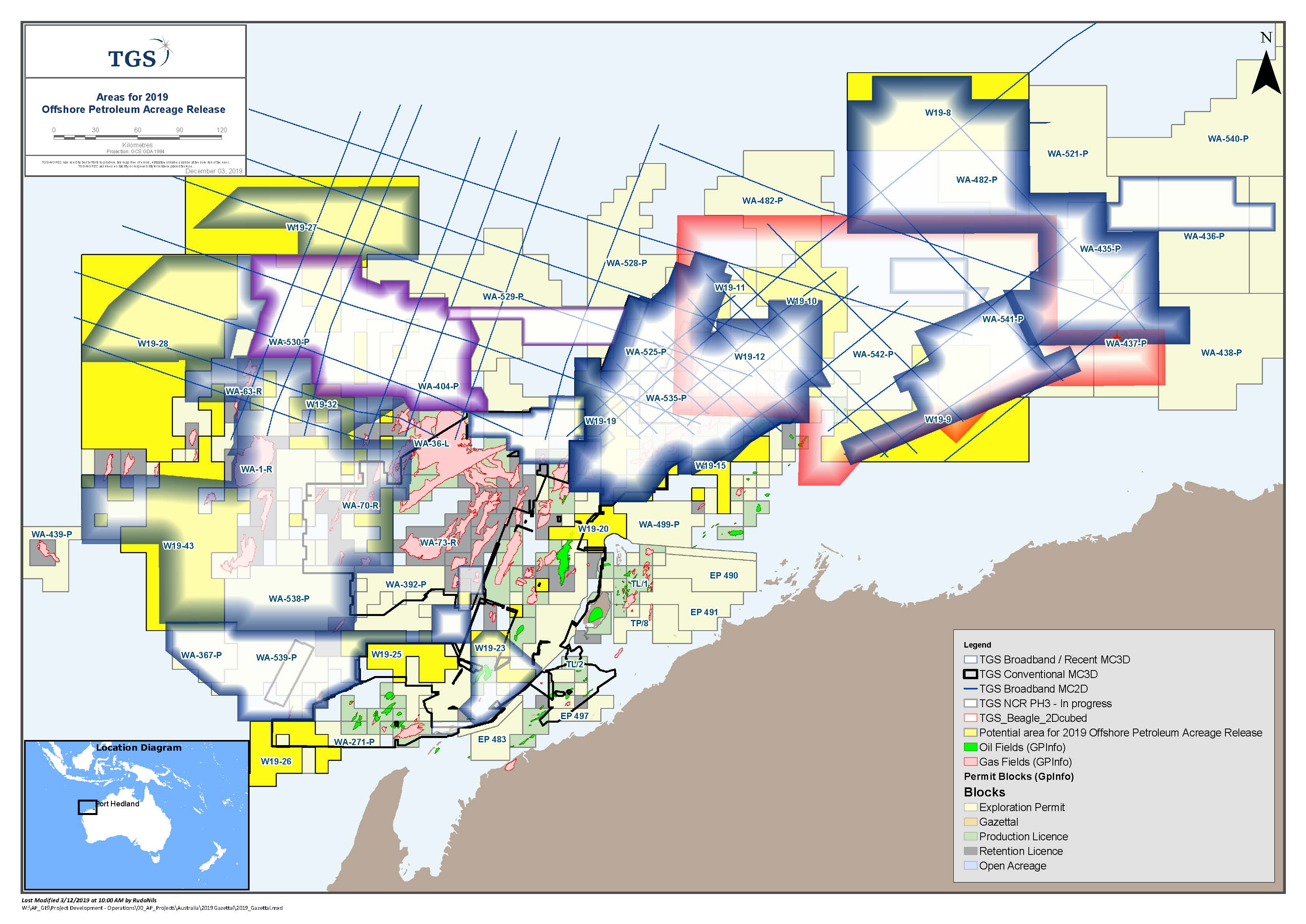
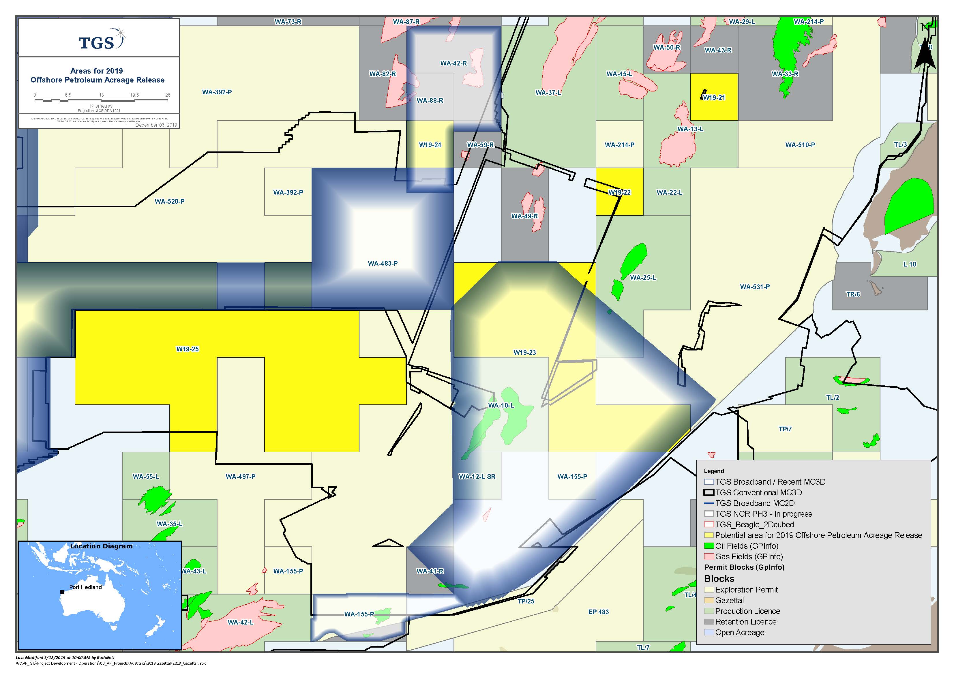
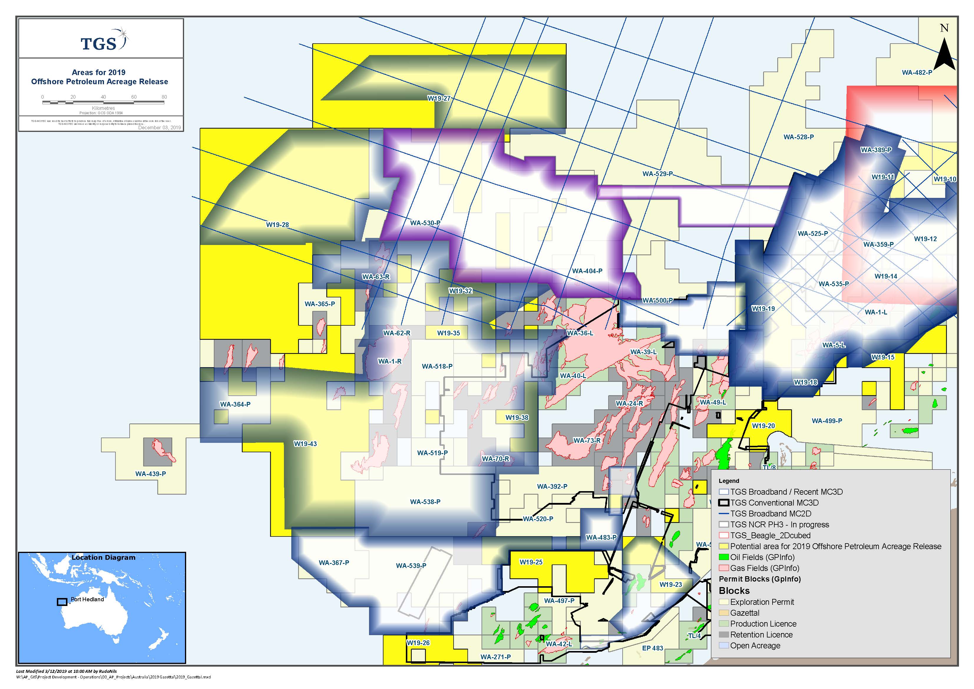
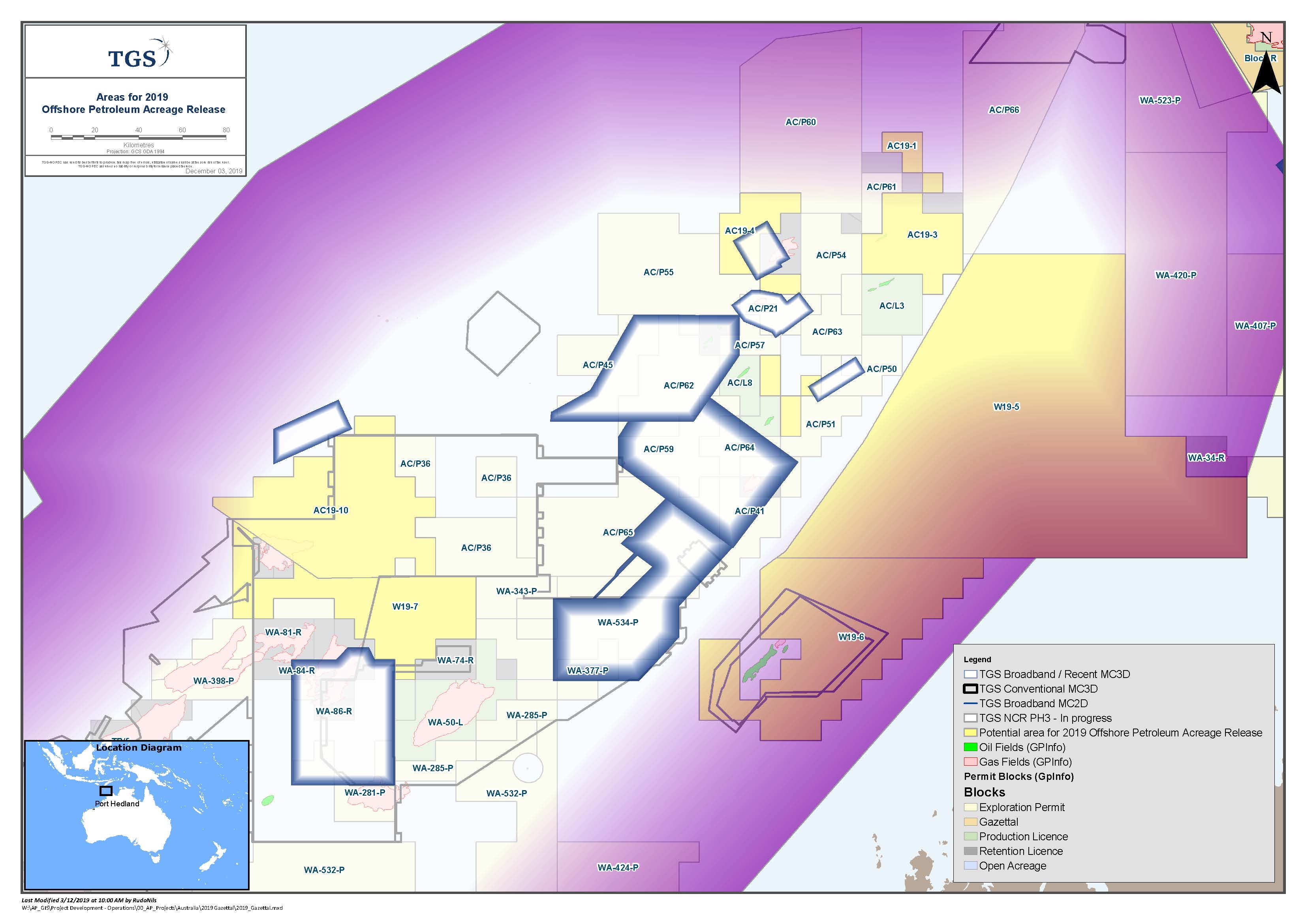
TGS data is available for the following areas in the 2019 acreage release:
Eastern Exmouth Plateau and Lambert Shelf: 13 blocks within the Northern Carnarvon Basin totalling up to 25,200 km2
- TGS datasets: Capreolus 3D, Polly 3D Reprocessing, Olympus 3D Reprocessing, Beagle 2Dcubed and Northwest Shelf Renaissance 2D
North Eastern Exmouth Plateau: 1 block within the Northern Carnarvon Basin totalling 6,853 km2
- TGS datasets: Capreolus 3D and Northwest Shelf Renaissance 2D
Northern and Central Exmouth Plateau: 20 blocks within the Northern Carnarvon basin, totalling 33,068 km2
- TGS datasets: Mary Rose 3D, Mary Rose Northeast Extension 3D, Gnaraloo-Cazadores 3D, North Carnarvon Basin 3D, North Carnarvon 3D Reprocessing and Northwest Shelf Renaissance 2D
Barrow Sub-Basin: 3 blocks within the Northern Carnarvon basin, totalling 2,715 km2
- TGS datasets: Huzzas Phase 1 and 2 3D, Eendracht 3D and Three Bears 3D
Browse Basin and Bonaparte Basin: 12 blocks totalling 33,523 km2
- TGS datasets: Northwest Shelf 2Dcubed Phase 2, Paqualin 3D and Talbot 3D
Otway Basin: 1 block totalling 1,295 km2
- TGS dataset: Otway 3D Reprocessing


Acreage
Eastern Exmouth Plateau and Lambert Shelf
The Eastern Exmouth Plateau is a prospective rifted depocenters, adjacent to proven oil and gas accumulations.
To date, the known play types are Triassic-Jurassic tilted faults blocks and grabens with associated folding, and Upper Jurassic basin floor fans at the edges of elevated horst blocks. The discovery of oil at Nebo, Finucane South and Fletcher within Jurassic reservoirs has proven the presence of a working petroleum system, there are large portions of the sub-basin that remain undrilled.
The Dorado-1 discovery in the Bedout Sub-basin has also highlighted the potential for a new oil play within the deeper Triassic successions sourced from mature Triassic organic-rich rocks, which is potentially analogous to the Triassic geology within the Eastern Exmouth Plateau and Lambert Shelf acreage release area given their similarities. Furthermore, there is evidence of a deeper Permian reef system extending from the Bedout Sub-Basin into the Lambert Shelf which can be seen on modern 3D.
Exmouth Plateau
The Exmouth Plateau makes up a large portion of the North Carnarvon Basin, that is characterised by a thick Triassic succession, and overlain by thinner Jurassic and younger sequences.
Gas has been the main phase of hydrocarbons discovered within the large N-S to NE-SW Triassic-Jurassic structural trends and within Cretaceous basin floor fans that were supported by strong direct hydrocarbon indicators. However, exploration drilling results over the last ten years in the Exmouth Plateau have hinted at the presence of an oil-prone Triassic petroleum system in addition to the proven gas play.
The recent discovery of significant oil and liquid-rich gas accumulations in the inboard Bedout Sub-basin, within Triassic reservoirs sourced from mature Triassic organic-rich rocks, has again highlighted the potential of the play in the offshore North West Shelf. Evidence indicating the presence of an oil generating source rock in the Exmouth can be found in the form of oil inclusions (Pinhoe-1), rock facies (Alaric-1) and fluorescence (Eendracht-1, Thebe-2) and gas to C5 readings (Dalia South-1).
Barrow Sub-Basin
The Barrow Sub-Basin is a proven hydrocarbon province, that is close to existing infrastructure, with several producing fields. Multiple proven plays include multi-level structural and stratigraphic plays in Triassic, Jurassic and Lower Cretaceous successions sourced from both oil- and gas-prone source rocks.
The extension of the known Triassic, Jurassic and Lower Cretaceous plays into the released acreage are highly likely due to their proximity to the producing fields. The identification of further subtle hydrocarbon trapping configurations within low relief structural closures and stratigraphic traps may not necessarily display a strong direct hydrocarbon indicators. Modern high-quality seismic datasets are required in order to reveal these subtle signs for the presence of oil and gas bearing reservoirs.
Browse and Bonaparte Basin
The Browse and Bonaparte Basins are two large rift basins that share the same tectonic evolution history at the larger scale. There are several production fields and oil and gas discoveries across numerous different stratigraphic ages with a wide range of trapping and reservoir methods that prove the prospectivity of the basins.
Otway Basin
The Otway Basin is a prolific within the onshore and offshore shallow water areas with commercial gas discoveries and large prospects further offshore. The most recent gas discovery made was in September 2019 at Annie-1. To date the basin remains largely under-explored and has a very close proximity to both market and infrastructure. There are two petroleum systems that are recognised within the basin, being the Middle to Late Cretaceous Austral 2 where existing shelfal discoveries have been made and the Late Cretaceous Austral 3 that is proposed to be at the shelf slope. The known play types include faulted anticlines, large anticlinal features and tilted fault blocks.
TGS survey data
Below are details of the TGS surveys listed within the nominated areas.
- Capreolus 3D was acquired in 2015 using long streamers and with deep record length, and processing was undertaken via Broadband PSDM workflow. The southern part of Capreolus 3D covers the shallower, highly prospective Bedout Sub-basin (including Phoenix South, Roc and Dorado discoveries) and the northern part covers the Exmouth Plateau in deeper water setting.
- Polly 3D in the Beagle Sub-basin has been reprocessed using the latest Broadband PSDM workflow and was completed at the end of December 2018. Polly 3D reprocessing is merged with Capreolus 3D to provide a unique modern consistent dataset.
- The Olympus Broadband Reprocessed 3D project is a new seamless pre-stack merged dataset providing broadband pre-stack time (PSTM) and pre-stack depth migration (PSDM) products over the Northern Carnarvon Basin. IT consists of 20 existing 3D datasets and processing of the dataset was completed in December 2017.
- Beagle 2Dcubed dataset was created using the open-file 2D and 3D seismic data within the Beagle Sub-basin using TGS’s 2Dcubed technology.
- The Northwest Shelf Renaissance 2D was acquired in 2016 with long streamers and deeper record length. Data processing was undertaken via Broadband PSDM processing workflow, with a focus on enhancing the imaging in complex areas and for deeper imaging of the basin. This survey was designed to provide a broader basin coverage with unrivalled stratigraphic control from numerous modern and deep key well ties.
- The North Carnarvon Basin Phase 1 and 2 3D Reprocessing Project was completed in August 2018. The 28,000 km2 volume is a merge of reprocessed multi-client data (including TGS’s Mary Rose 3D, Mary Rose NE Extension 3D and Honeycombs 3D) and open file surveys, covering several gas fields and wells over the outboard Exmouth Plateau and Investigator Sub-basin. Data reprocessing was undertaken via broadband PSDM workflow. Phase 3 is currently underway and is a northern extension of the completed Phase I & 2 project. The final product deliverables will be available at the end of September 2019.
- The North Carnarvon Basin 3D was acquired in 2015 using long streamers and deep record length. The coverage spans the outboard section of Exmouth Plateau in deeper water settings.
- Eendracht 3D was acquired in 2010 and data processing was undertaken via pre-stack time and depth migrations.
- Huzzas 3D was acquired in 2014 in two phases within the Barrow Sub-basin. Data reprocessing was undertaken via broadband pre-stack depth migration (PSDM) workflow.
- The Three Bears 3D was acquired in 2012.
- Northwest Shelf Phase 2 2Dcubed dataset is currently being processed using the open-file 2D and 3D seismic data within the Browse Basin and Bonaparte Basin using TGS’s 2Dcubed technology.
- Otway 3D Reprocessing comprises 7,950km2 of 3D data from 16 existing 3D surveys and about 7,000km of 2D data which will be reprocessed through high-end pre-stack time migration (PSTM) and pre-stack depth migration (PSDM) broadband sequence.
Contact TGS for more
in-depth information on the latest acreage round
Australian acreage 2019
TGS provides the industry with the right data, at the right time, in the right place. Energy Starts With Us!
%20(003).jpg?width=300&name=TGS-Logo-400px-72dpi%20(002)%20(003).jpg)