
Offshore Brazil Open Bid Rounds
With over 649,000 kilometers in 2D multi-client data and ~270,900 square kilometers in 3D multi-client data in Brazil, our seismic data covers every basin, sector and block offshore Brazil in the upcoming bid round cycles.
Brazil's Open Acreage Oil and Gas
Bidding Rounds
The National Agency of Oil, Natural Gas and Biofuel – ANP – maintains the Open Acreage of exploratory blocks and areas with marginal accumulations for awarding concession agreements for exploration or rehabilitation and production of oil and natural gas. At each new cycle of the Open Acreage under the concession or production sharing regime, a schedule is published with dates and deadlines for payments, delivery of documents and other relevant information.
In December 2024, The ANP Board approved the geological and economic studies of three exploratory blocks, located in the Santos Basin Pre-Salt, for possible inclusion in future rounds of bidding for areas for exploration and production of oil and natural gas. The total area of the three blocks is approximately 11,300 km² and their oil potential was estimated considering an in-place volume of 16.8 billion barrels of oil equivalent.

Data for Discoveries
Over the last 30 years, the vast “petroliferous” margins of Brazil have consistently provided some of the largest discoveries in the world. High-quality seismic data is the pathfinder for exploration and production companies, not only to develop the best resources of the pre-salt play of the Santos and Campos Basins, but also to unleash the high potential of the underexplored Aptian rift/syn-rift play and deep water clastic and carbonate plays of the Ceará and Potiguar Basins of the Northern Equatorial Margin.
.png?width=395&height=692&name=Untitled%20design%20(28).png "Untitled design (28)")
.png?width=395&height=692&name=Untitled%20design%20(29).png "Untitled design (29)")
.png?width=395&height=692&name=Untitled%20design%20(27).png "Untitled design (27)")
.png)
Foz do Amazonas, Pará-Maranhão and Barreirinhas Basins
Our data library offers over 11,000 square kilometers of 3D data over the Foz do Amazonas basin and over 35,000 kilometers of 2D data from which more than 20,000 kilometers were recently reprocessed (2019 – broadband). In Pará-Maranhão, we recently added over 8,000 kilometers of 2D data to expand its coverage of an area that already has over 25,000 kilometers of 2D data newly reprocessed (2020). Barreirinhas basins is fully covered by 2D modern dataset of long offset acquired in 2017.
Ceará and Potiguar Basins
Ceará basin is fully covered by modern and long offset dataset acquired in 2018 that is completely covering all the blocks on offer in the ANP bid round cycles. Potiguar is an area where TGS had heavily invested in the last three years. In 2019, TGS added over 10,000 square kilometers of 3D data, reprocessed with high-end technology such as Dynamic Matching FWI (2021). Potiguar is an area also fully covered by 2D modern seismic from which part of it was only acquired in 2020. Chosen datasets can be scaled for the maturity of the evaluation: a regional grid of 2D data for basin characterization, play potential recognition, and the presence of reservoir, seal, and source rocks.
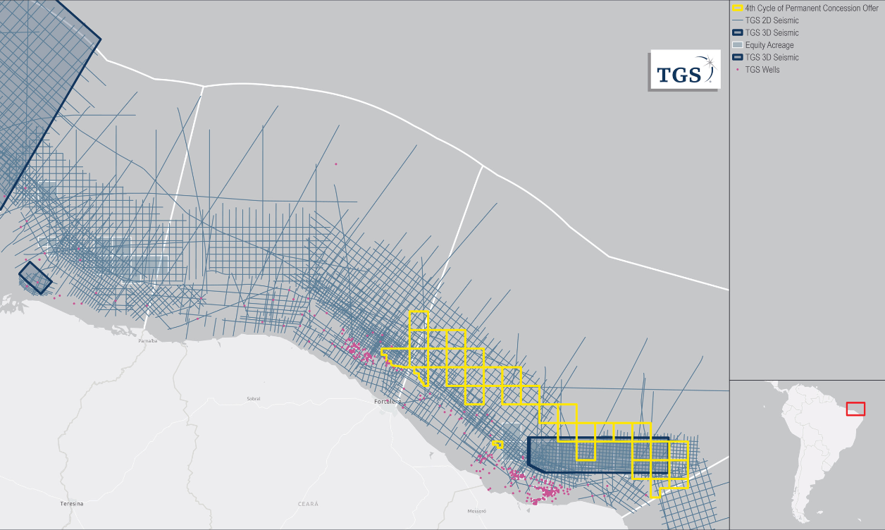
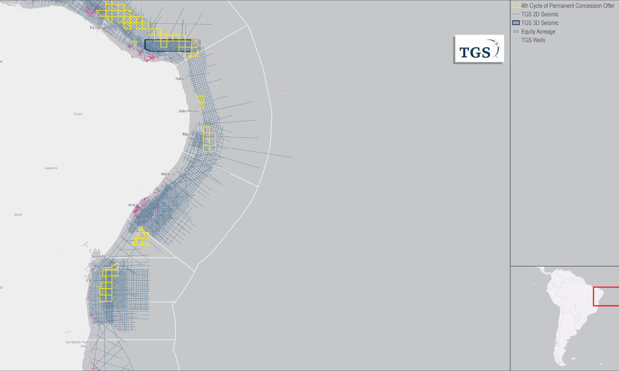
Pernambuco-Paraíba and Sergipe-Alagoas Basins
TGS offers 16,300 km of long offset 2D data in the Sergipe Basin. This data, and the 8,000 km of legacy data on the Sergipe shelf, underpin the plays into deeper water adjacent to the Petrobras blocks. This data has been depth processed to suit the complex structural geology of this basin and can be considered as the main hydrocarbon generating sub-basin. The TGS Regional 2D seismic grid identifies the active petroleum system and multiple leads in the Sergipe-Alagoas Basin. Pernambuco-Paraíba basin has a great coverage of 2D grid, 5,400 kilometers of modern offset acquired in 2018.
Campos and Santos Basins
TGS holds the most extensive 2D and 3D seismic data coverage in the Campos and Santos basins, enjoying an exclusive position over much of the ANP bid round cycles. This highly coveted area holds blocks surrounded by major operators, and our supporting data in the area allow the structural highs for the blocks on offer to be clearly identified and mapped.
.png)
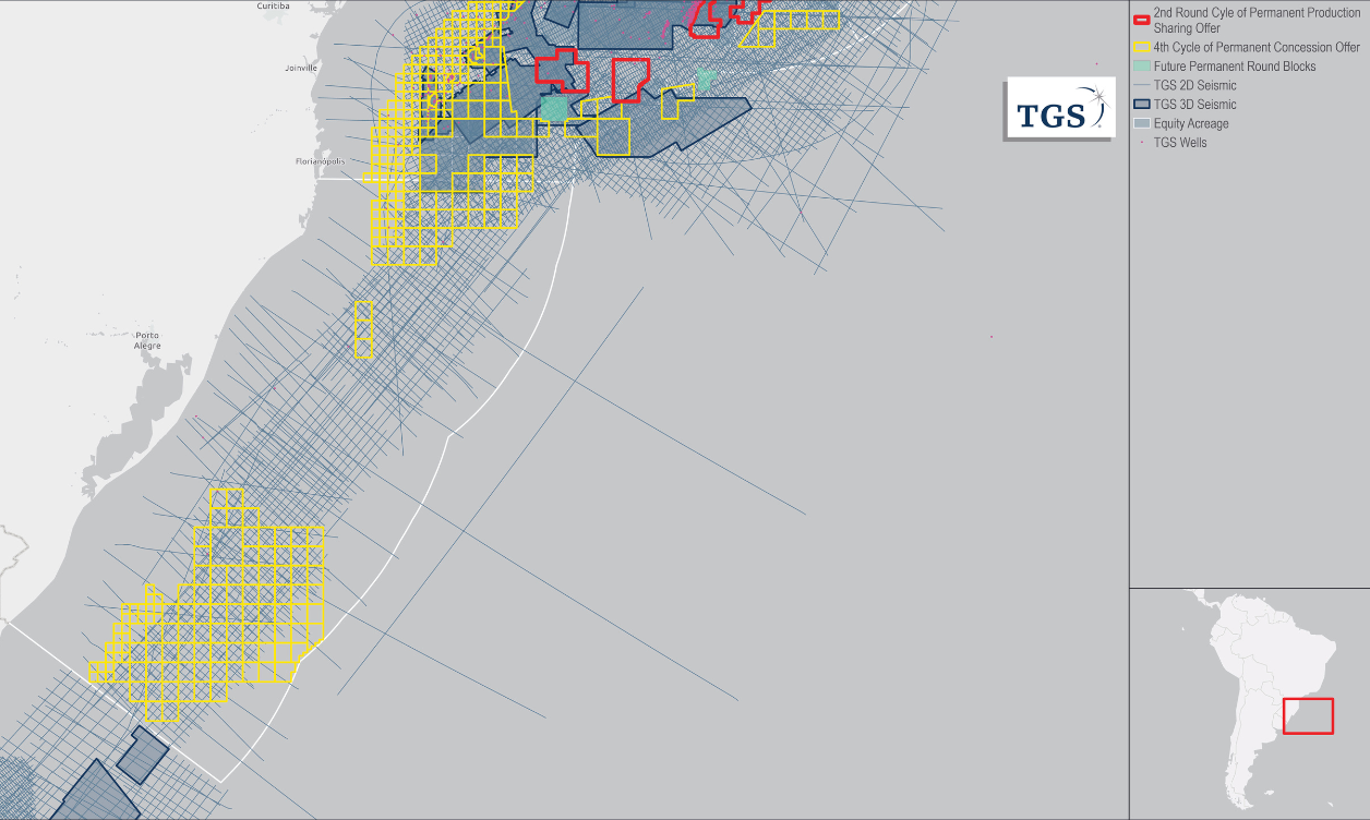
Pelotas Basin
TGS is heavily investing in Pelotas to ensure the best coverage in an area we believe to have an enormous potential. In 2019 TGS reprocessed 2,700 kilometers of 2D data using broadband technology and producing KPSTM and KPSDM. In 2021, a new acquisition was completed and added an additional 9,300 kilometers of very modern 2D data covering a great part of the blocks on offer North of Pelotas. Overall, Pelotas basin is covered, from North to South with more than 41,800 kilometers of data allowing a broad regional understanding of the potential and opportunities available in the area.

Speak to a Specialist
Interested in a product demo or trial? Let us know your needs and we’ll connect you to the right person or team.
Book a Data Viewing
Want to see the latest seismic data solutions and imaging technologies in your region of interest or for the next license round? Book a data viewing with one of our experts.
Discuss Your Seismic Data Needs
Every need is different and we'd like the opportunity to discuss yours further. Speak to one of our data or geoscience experts to customize seismic solutions specific to your requirements.