Amendment
U.S. Gulf of Mexico Ultra-long Offset OBN


Amendment Phase 1 & 2
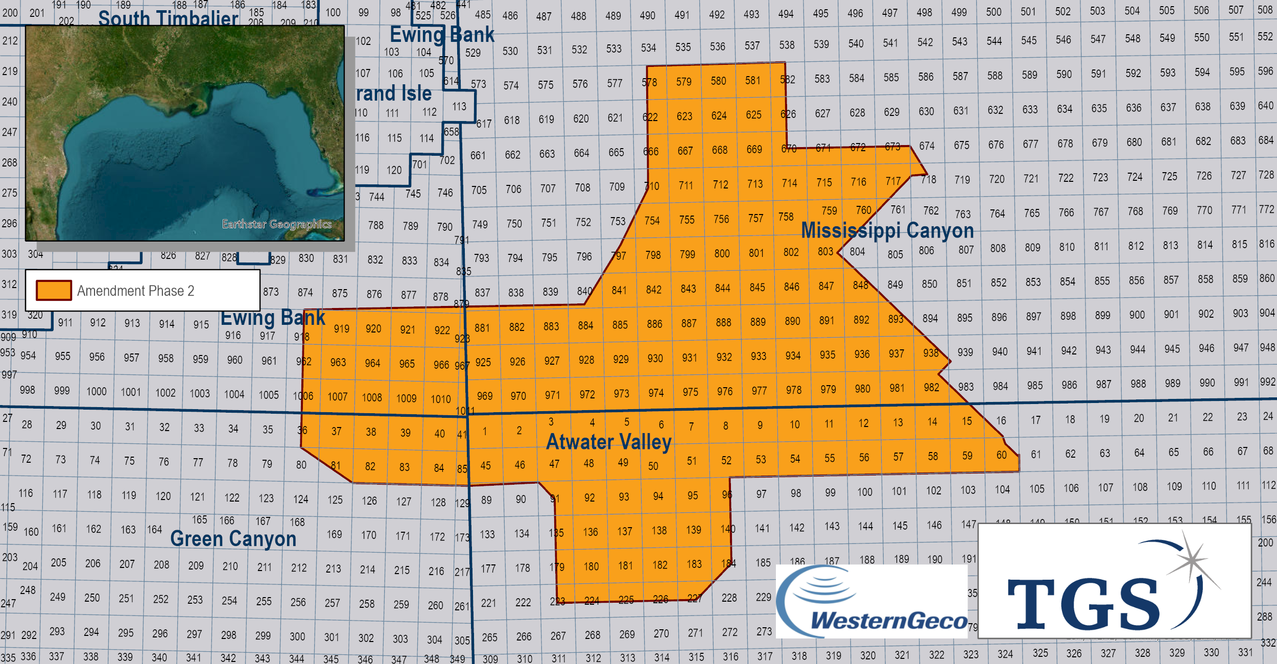
The Amendment Phase 1 FWI node survey is the largest multi-client deepwater node survey ever delivered in the U.S. Gulf of Mexico (GoM). The survey was optimized to acquire a minimum of 40-kilometer ultra-long offsets - another industry first for an area of this size. Amendment Phase 1 was acquired in water depths of up to 2,070 meters and covers 118 OCS blocks (2,765 square kilometers). The final data is now available.
The next phase, "Engagement," extends the footprint of ultra-long data in the Northern Green Canyon protraction area.
In September 2022, TGS announced Amendment Phase II, a continuation of the original survey including 151 OCS blocks, currently in acquisition as of December 2o22. This survey is expected to be completed during the first quarter of 2023.
Key to this project is the uplift this data will bring to full-waveform inversion (FWI) velocity model building. The results from this data following processing are expected in Q4 2023. On completing this project, TGS will have built a library of over 550 OCS blocks of ultra-long off-set data in the U.S. Gulf of Mexico over the past four years.
Our Data Coverage
The next generation of exploration data is here!
OBN data provides very low noise data but also allows many more survey design options. As the source vessels move independently to the nodes, which remain stationary on the seabed, azimuth and offset can be selected optimally for survey objectives. As FWI algorithms need long offset refraction information a new survey design was created and optimized for Amendment.
In the images to the right, the starting model shows velocity model from legacy dual WAZ dataset (Fusion M-WAZ). The second model shows the fast track FWI derived update. The improved velocity model highlights salt feeders and stock, steeply dipping beds and a more continuous Louann level base of salt.


Dynamic Matching FWI
Amendment is the first project to utilize Dynamic Matching Full-Waveform Inversion (DM-FWI) from TGS for a high-resolution velocity-model update, which focuses on solving kinematic difference between input data and synthetic data. With the data residual calculated in localized windows in time and space, DM-FWI provides a robust velocity-model update using the total energy in the data including both diving wave and reflections. The application to Amendment sparse node dataset with ultralong offsets in Gulf of Mexico shows its capability to resolve large velocity errors and give significant uplift on sub-salt image.
The starting model ("before"), in the image above, shows legacy dual WAZ dataset (Fusion M-WAZ). The end model ("after") shows the fast track DM FWI derived update and imaging enhancement from long offset, low noise OBN data. Improved velocity model improves the imaging sub salt.
The next generation of exploration data is here!
In the images to the right, the "before" model shows velocity model from legacy dual WAZ dataset (Fusion M-WAZ). The "after" model, shows the fast track FWI derived update. Improved velocity model highlights: salt feeders and stock, steeply dipping beds and a more continuous Louann level base of salt.
Amendment Phase 1 was acquired in partnership with WesternGeco and processed by TGS.


