
Timor-Leste's Latest Bid Round
On October 3, 2019, Timor-Leste's Prime Minister, Taur Matan Ruak opened a license round for exploration and exploitation of petroleum in the country, only the second in its history. This round offered opportunities to invest in the potential of oil and gas and create new partnerships to jointly develop this potential. The Licensing Round followed Timor-Leste and Australia exchanging Diplomatic Notes to bring into force the treaty between the two countries, establishing maritime boundaries in the Timor Sea.
The deadline for bid submission was March 4, 2022.
.png?width=690&name=Timor-Leste%20License%20Rd%202%20(without%202D).png)
TGS offers a fantastic regional overview and license round insight with its 2Dcubed data
The country has also established the Petroleum Fund to provide full transparency and proper management of its petroleum revenue for current and future generations. It is only the third nation in the world, and the first in Asia, to sign and fully comply with the Extractive Industries Transparency lndex. Additionally, the Timor-Leste Strategic Development Plan designates petroleum as a strategic industry that will underpin the country's economic growth, job creation and future progress as a successful and stable nation.
The Strategic Development Plan aims to secure the opportunities of the petroleum sector for its people through employment and training, building its national petroleum company, Timor Gap, and developing petroleum related industries across Timor-Leste.
Terms for the 2nd License Round
When the License Round kicked off in October 2019, the Timorese Government set out various aspects of the Round that will help companies to determine how to proceed. For example, with regards to fiscal regime, there was no signing bonus, rather the ANPM - Timor-Leste's petroleum and mineral regulatory - will be assessing individual companies' technical and financial capabilities and their work programs and environmental records.
PSCs are offered for a period of seven years and state participation will be up to 20%. There was a 5 percent royalty to the ANPM and full Cost Recovery (no limit) on Exploration, Capital and Operational costs, profits will be split 60 percent to operators, with 40 percent to the government. Income tax is 30%. There is no vertical limit; companies may drill to any depth without a change in royalty or ownership.
The Timorese Government has stated that there will be local content requirements, and these will be set out in due course.
Link to bid round web page: http://licensinground.anpm.tl/
TGS available data
In collaboration with the ANPM, and supported by industry TGS has a 2Dcubed seismic data project covering offshore Timor-Leste. The project combines all available open file and applicable TGS multi-client data across an area of over 50,000 square kilometers, incorporating over 2,500 2D seismic lines and all existing open file 3D seismic within the project area. The data, from over 45 legacy vintages, covers the entire offshore area south of Timor-Leste where the 11 offshore blocks in the second license round are located. This product provides a single contiguous, seamless volume of data ideal for license round block evaluation. TGS’ 2Dcubed volumes have proven to be a success in many basins globally, supporting license rounds and regional studies. Utilization of this technology in Timor-Leste will not only create a comprehensive regional 3D dataset for ease of acreage evaluation but also delivers a fully conformable Post-Stack Phase, Time and Amplitude matched and merged 2D and 3D volume from which interpretation can be refined prior to making the all-important next investment decision.
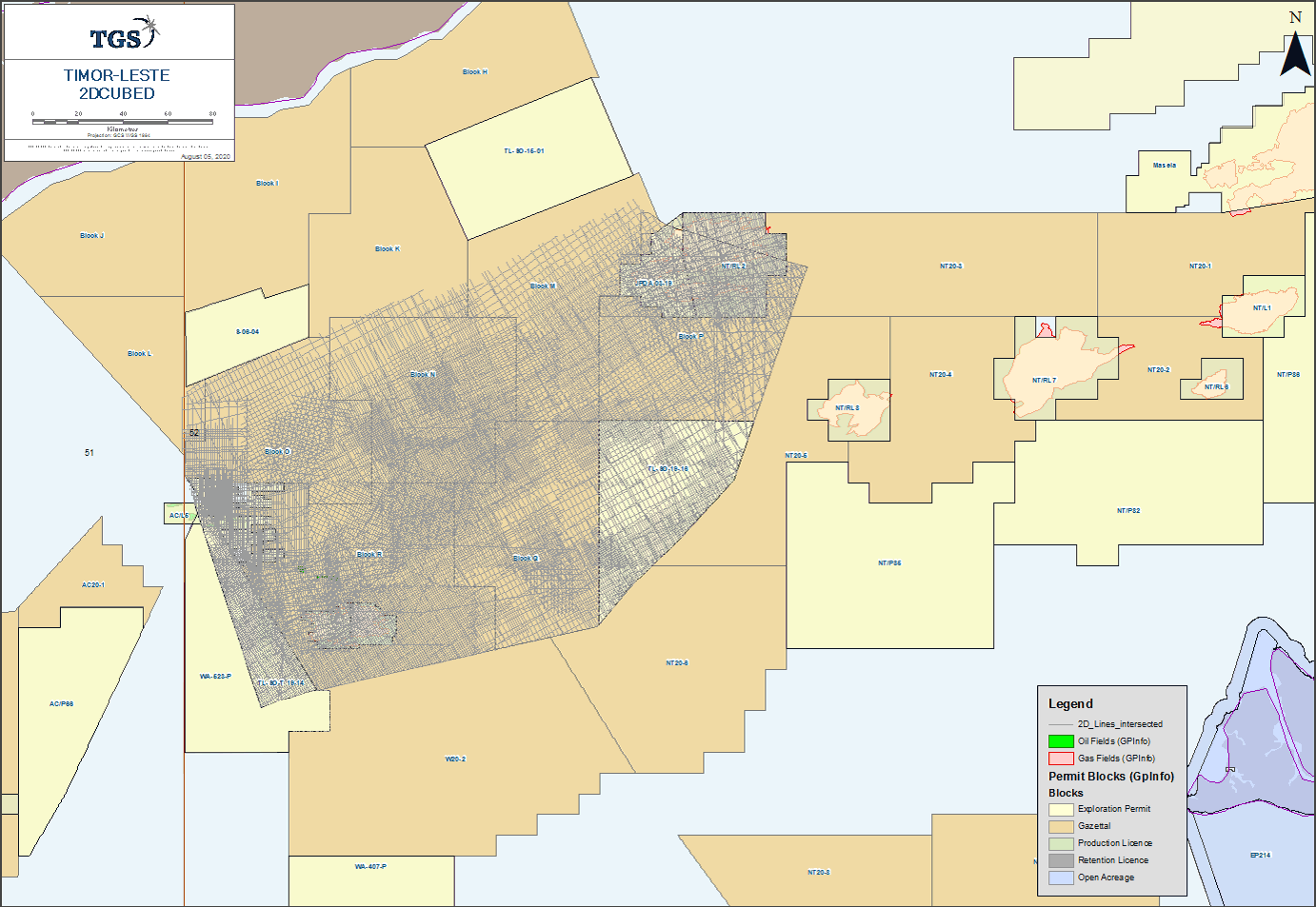
The TGS Timor-Leste 2D-cubed project covers over 50,000 km2 and incorporates over 2,500 2D seismic lines plus all existing open file 3D seismic within the area. First deliverables are now available for licensing.

In addition to the 2Dcubed project, TGS holds a large library of legacy 2D and 3D Seismic data offshore Timor-Leste. A large proportion of this data has been pre- or post-stack reprocessed since its original acquisition and processing. Notable datasets include the ET-05 2D extending across the thrust belt and the Kyranis 3D that covers the Chuditch discovery straddling the border with Australia.
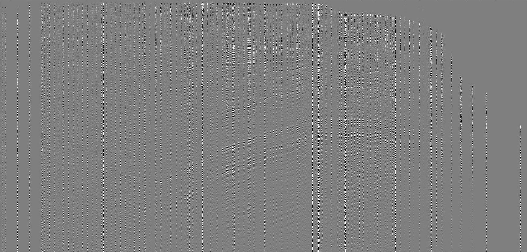
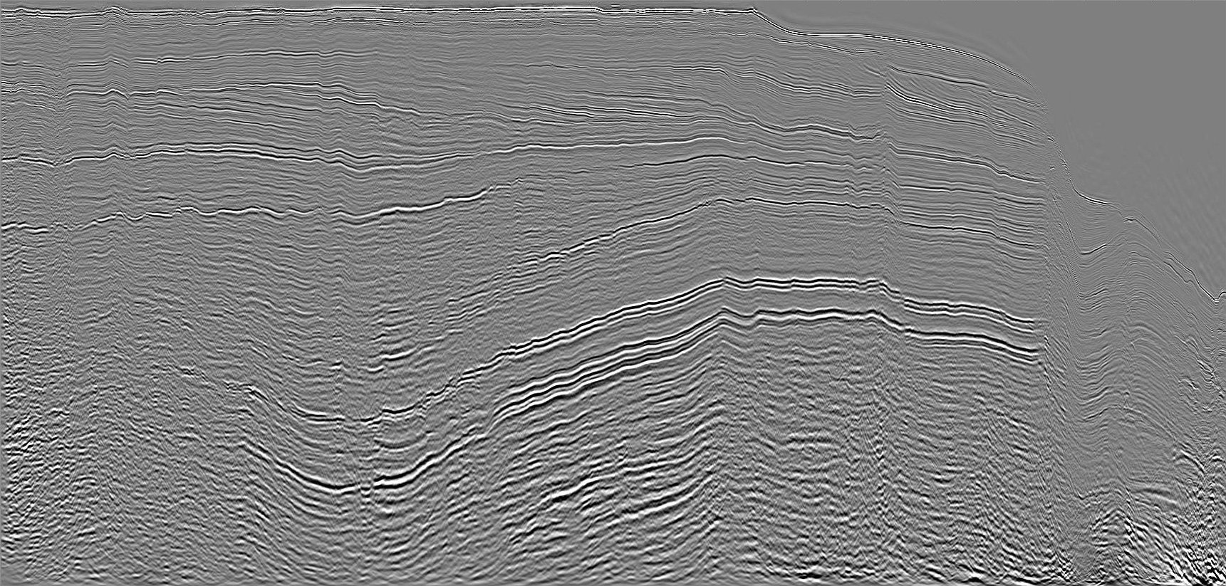
First deliverables now available. Above is a comparison between 2D intersecting lines and the resultant 2Dcubed 3D section image

Geological Insight
Offshore Timor Leste has an extensive proven working petroleum system with many examples of oil and gas discoveries. Up until recently, exploration over the past 13 years has slowed while Australia and Timor Leste have come to an agreement on their boundaries. Following ratification of the agreed boundary in 2019, the area is ready for its next phase of oil and gas exploration, assisted by the benefits of the application of modern seismic processing. There is remaining potential in the low risk and established petroleum systems and also with new, frontier plays that have yet to be thoroughly tested here.
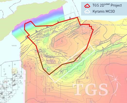
The TGS’ 2Dcubed project covers the entire former JPDA area from Buffalo, Laminaria and Bayu Undan discoveries in the South West across the Flamingo Syncline and Sahul Platform to Sunrise and Troubadour in the East
The established petroleum systems consist Gas prone Mid Jurassic Plover formation coals charging Jurassic and Early cretaceous sands and Late Cretaceous carbonates with additional firm evidence of an oil-prone Early Cretaceous Echuca Shoals Formation. The next phase of exploration is targeting reservoirs in the Permian and Triassic section, analogous to the famous Dorado discovery.
The Malita Graben, trending along the southern boundary of the former JPDA area lies within a larger Late Carboniferous to Early Permian basin with a NE-SW rift orientation. This initial rifting ceased by the end of the Permian and was then followed by a post rift sag phase during the Triassic and through to the Middle Jurassic. A second phase of rifting then accentuated the existing graben during the Callovian.
TGS’ Timor Leste 2Dcubed project will not only create a 3D seismic volume (using multi-vintage 2D data) interpretable at a regional scale but will also produce a regionally consistent velocity model.
Find out more
Please fill in the information request form on the top right-hand section of this page for any specific information you require. Alternatively, please contact Tom Kipling, Business Manager, Asia: Tom.Kipling@tgs.com
